
Saga GIS
[Workflow for basic terrain-analysis in Saga GIS]
01. download Tile (DEM file as gird) on:
https://digital-landscapes.com/academic-work/arctic-studio/
02. go to downloads >>> unzip the folder to Your GIS-Database-Folder
03. open SAGA-GIS
04. go to Tools tab >>> Import/Export – GDAL/OGR
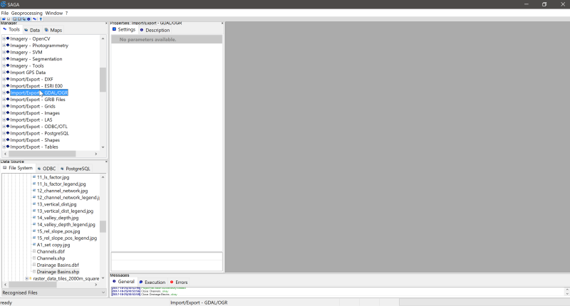 05. Import/Export – GDAL/OGR >>> browse file >>> select .sdat – file in Database-folder


 06. switch to Data-tab >>> right click on image >>> “Add to Map”
 07. switch back to Tools-tab >>> dobble click on Basic Terrain Analysis under the Terrain Analysis – Compound Analysis tab
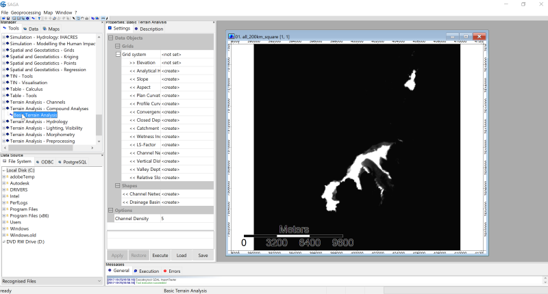 07. select Grid system and Elevation (Input) > create maps (Output) > click OK
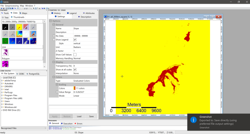
 08. switch back to Data tab >>> right click on images and >>> add to map | or >>> save image to a specific folder location as .png (incl. georeference)


software: opensource GIS: © Saga-GIS
dataset: © https://kartverket.no/
further links:
http://www.saga-gis.org/en/index.html
https://sourceforge.net/projects/saga-gis/
http://www.qgis.org/en/site/
screenshots & workflow by marc ihle
Maya
[Workflow for basic poly-modeling | Xgen | Boss | Rendering]
Luca_Melchiori_Basic_Modeling_Tutorial
Luca_Melchiori_BOSS_Tutorial
Luca_Melchiori_Xgen_Tutorial
screenshots & workflow by luca melchiori
Rhino & Grasshopper:
BAC 2017-11-29 dtm to single surface [Grasshopper script that generates a single surface from an .asc file
3d-scan (mobil):
http://www.trnio.com/ [for i-phone]
http://scann3d.smartmobilevision.com/
https://itseez3d.com/
https://www.scandy.co/