

Terrain Diversity
The instrument needs a wide screen to be usable — the parameter column and the terrain view sit side by side, and the readouts are meant to be read while you shape the ground.
Open anywayEverything runs inside your browser. The terrain you load is never uploaded, and nothing is sent anywhere.
DL-TerrainDiversity is a terrain design instrument: change the ground, and water, energy, landform and a modelled species assemblage answer in the same frame.
A terrain analysis instrument. Not a prediction.
A Terrain Design Information Model (TDIM) · open source (Apache‑2.0) · v0.13.1 · runs in the browser, nothing to install
Grading is normally drawn and then, separately, assessed — the drawing comes first and the consequences arrive later, in another program, often in another office. Here the order is reversed. The ground is the model; the slope, the water that runs off it, the radiation it receives, the shelter it offers and the species that could occupy it are read from that same surface as it changes. The drawings — grading plan, sections, isopach, GIS rasters — are derived from the model rather than drawn over it, so they cannot quietly disagree with it.
What it is not is a forecast. The species readout is a modelled response to measured terrain, not a claim about what will grow; the hydrology is a flow-accumulation model, not a catchment study. It is an instrument for thinking with, at design speed — which is why the honesty line above is on the tool itself, not only on this page.
Where it comes from
The Terrain Design Information Model is not new here. It was defined and applied in 2018, in Case Study Festvåg, under an Innsbruck affiliation — four years before any of the teaching work this practice later did in Norway. What is new in 2026 is that the model has become an instrument anyone can run, archived with a DOI so the version behind a drawing can be named.
2018
The definition
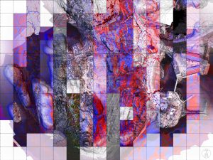
Case Study Festvåg — digital Terrain Design Information Model (TDIM): multiscalar data integration and processes of terrain analysis, from UAV survey and open Kartverket geodata.
Read the 2018 case study2026
The instrument
DL‑TerrainDiversity v0.13.1 — the same model, released as software: browser‑based, open source, archived and citable, with its verification suite included.
The archived release (DOI)The archive records the descent itself: the Zenodo record lists the 2018 case study as the work this software is derived from.
Check it yourself
The analysis kernel and the rendering both ship with their own test suites, and they run in the browser — not as a screenshot of a result, but as the checks themselves, executing on this machine against analytic surfaces with hand‑computable answers and against the real Ørndalen LiDAR figures.
Run the analysis‑kernel suite → · Run the render suite →
These are the suites inside the build running on this page, which is the released v0.13.1 itself: 652 kernel checks and 165 render checks. All 165 render checks pass. Eight kernel checks fail, and they are meant to — they measure a drawing’s stated scale against its own geometry, and seven exported sheets state a scale they are not drawn at. The checks stay red until the exporters are fixed; a suite that is green because its checks were loosened proves nothing. They take a few seconds and need a reasonably current browser; the render suite needs WebGL.
Citation and source
| Cite | Ihle, Marc‑Eduard (Digital Landscapes). DL‑TerrainDiversity: A Terrain Design Information Model (TDIM) for landscape architecture, v0.13.1, 2026. https://doi.org/10.5281/zenodo.23282210 |
|---|---|
| Source | github.com/DLandscapes/dl-terrain-diversity |
| Licence | Apache‑2.0. The vendored third parties keep their own: three.js (MIT), Source Sans 3 and Quattrocento Sans (OFL), each licence travelling beside the files it covers. |
| Terrain data | © Kartverket (hoydedata.no), NLOD / CC BY 4.0. The synthetic teaching tile is generated, not measured — every cell exactly 75.000 m. |
Terrain you load stays on your machine.
Developed by Digital Landscapes with AI assistance. The Terrain Design Information Model, the design decisions and all verification are Digital Landscapes’ own.